Thursday, April 18, 2019

Videos


Marsabit

Marsabit is a town in the northern Marsabit County in Kenya. It is situated in the former Eastern Province and is almost surrounded by the Marsabit National Parkand Marsabit National Reserve. The town is located 170 km east of the center of the East African Rift, at 37°58' E, 2°19' N (37.97°E, 2.32 N) at an elevation of between 1300 and 1400 metres[1]. It serves as the capital of Marsabit County, and lies southeast of the Chalbi Desert in a forested area known for its volcanoesand crater lakes and others.
Marsabit
Town
The Marsabit-Moyale road.
Marsabit is located in Kenya
Marsabit
Marsabit
Location in Kenya.
Coordinates: 2°20′00″N 37°59′00″E
Country Kenya
CountyMarsabit County
Elevation
1,350 m (4,430 ft)
Time zoneUTC+3 (EAT)

OverviewEdit

The town of Marsabit is an outpost of urban civilization in the vast desert of northern Kenya. The town is situated on an isolated extinct volcanoMount Marsabit, which rises almost a kilometer above the desert. The hills here are heavily forested, in contrast to the desert beyond, with their own "insular" eco-system. The town currently has a population of about 5,000.
Marsabit is located southeast of the Chalbi Desert.
The town is mainly inhabited by the Cushitic-speaking BoranaBurjiGabbraand Rendille. There are also some NiloticTurkana and Bantu Ameru residents. Additionally, there are a few Somalitraders.
Marsabit has an airstrip and a mountain peak (Mount Marsabit), with "singing" wells just outside the town. Elephants can also often be seen in the local wildlife refuge that surrounds the town, occasionally breaking down fences and causing damage to local farmers crop beds.
The name is possibly from the Amharicword 'Marsa bet' (Meaning Marsa's home/house) and is believed to have been named after a farmer named 'Marsa' (ethnically Burji) who was brought to Marsabit from Mega (in Ethiopia) by the Consul to assist in consolidation of farming and permanent settlement on the slopes of Mount Marsabit.

Culture and religionEdit

Stone pit right outside the far out town of Marsabit.
Besides the aforementioned ethnic groups, there are other people from other parts of Kenya who are there working mostly for the government and business. Muslims, Christians and adherents of traditional religions all inhabit the town.
Marsabit is the announced location for a conference between Borana and Gabra elders scheduled for 2–6 June 2009. Discussions to resolve existing conflicts between the two groups have been underway for several years now, and agreements are expected to be sealed at the event at this conference in the presence of traditional leaders.[2]

TransportEdit

Aerial view of area on the outskirts of Marsabit.
Marsabit is approximately 550 kilometers or 7 - 8 Hour drive from Nairobi via the towns of Isiolo and Archers Post. Accessing the town was previously a challenge as you had to either hang on top of the trucks or hike lifts in government vehicles. Currently, there are multiple bus services which ply the Isiolo - Marsabit route on a daily basis. It leaves Isiolo for Marsabit at 8pm, arriving between 3 - 5am and leaves Marsabit at 8am arriving in Isiolo between 3 - 7pm. In addition to this, there are other buses which ply the Nairobi - Moyale route, through Marsabit.
The road has been recently paved and connects all the way to the Kenya-Ethiopia Border at Moyale. It is approximately 277 kilometers from Isiolo and takes between 3 and 4 hours.
There are two airstrips servicing charter aircraft one close to town about 10 minutes Drive towards Moyale (Marsabit Airstrip) and the second about 30 minutes away towards Chalbi. (Segel Airstrip) The Mission Aviation Fellowship (MAF) flight is the only regular flight to Marsabit on Tuesdays and Fridays.

EconomyEdit

Camels watering in Marsabit.
Marsabit town is a trading and commercial center, with three petrol stations, three commercial banks, post office, shops, restaurants, lodges and even a dry cleaner. The town facilitates the supply and movement of goods and services between Moyale (goods from Ethiopia) and Isiolo (goods from Nairobi). Agriculture also plays a role, as many grow millet and maize to be consumed locally and nomadic people supply beef by selling their cows.
Lake Paradise (which attracts game animals such as elephants and buffalo), and Bongole Crater located in the heart of the forest are both local attractions for tourists. The town and surrounding area are of rich cultural interest to anthropologists and other researchers.

Solar eclipse of November 3, 2013Edit

Marsabit was listed as one of the locations that would experience a total solar eclipse on November 3, 2013. The total solar eclipse would have lasted a maximum of 1 minute and 39 seconds. About 1,000 tourists flocked to Sibiloi national park to get a glimpse of the rare occurrence.[3]
Best Hotels in Marsabit 

Nomads Trail Hotel in Marsabit, Kenya, boasts an on-site restaurant and a conference room. Guests can access the facility from the Marsabit Airport which is nearby.

Each tiled room has a wardrobe, a bed draped in mosquito netting, safety deposit boxes, a TV with satellite channels and an en-suite bathroom with satellite channels.

Breakfast is served daily. The onsite restaurant serves African dishes.

Laundry services are offered onsite. The premises are guarded round the clock and onsite parking is also available.

Nomads Trail Hotel is in close proximity to the Marsabit Stadium.

GOF HOTEL 

Gof Hotel is situated in Marsabit, within 21 km of Marsabit National Park and 23 km of Marsabit National Reserve. Boasting a 24-hour front desk, this property also provides guests with a restaurant. Choba Crater is 11 km away. 

At the hotel, each room is fitted with a wardrobe. The private bathroom is fitted with a bath and free toiletries. The units at Gof Hotel are fitted with a seating area and a flat-screen TV with satellite channels. 

A halal breakfast can be enjoyed at the property.

Isiolo

Location of Isiolo in Kenya
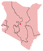
Isiolo is a town in the former Eastern ProvinceKenya. It is situated in the Upper Eastern sub-region, and lies 285 kilometres north of Nairobi, the capital city of Kenya. The town grew around the local military camps, much of the population being descended from former Somali soldierswho had fought in World War I as well as other Cushitic-speaking pastoral communities and the Ameru community. The town has an estimated population of 80,000 people, most of them living in the rural outbacks of the District. There is an increasing urban population in the recent years, especially from as far as Moyale, Marsabit and Mandera. The Isiolo town is also becoming a centre of interest because of its newly acquired status as a resort city cashing in on the popular Samburu and Shaba Game reserves, which have become preferred destinations after the famed Maasai Mara.[1] Isiolo lies along the long A2 Road, leading towards Marsabit and Moyalemuch farther north. The town is served by Isiolo Airport, which is set to be upgraded to an International Airport to serve tourism and local exports.[2]

OverviewEdit

Isiolo is set to become a major part of Kenya's economic development plan Vision 2030.[3] The plan calls for Isiolo to become a tourist center that will include casinos, hotels, upscale retail outlets, a modern airport and transport facilities. Isiolo will also be a transport hub as the location of the fork of the LAPSSET.
Isiolo District was designated as the Headquarters of the Northern frontier Districts by The British East Africa Protectorate in 1922, until the North Eastern was curved out as a separate province in 1963 following the Lancaster House Constitutional conference.
Isiolo is also known for its large market, while brass, copper and aluminum jewelry[4] making is a local industry. Isiolo town is also transport hub to the northern border town of moyale. Trucks to and from Moyale make stop overs boosting the hotel business in the town center. Isiolo town itself was a part of the Nyambene county council and was transferred to isiolo district (this info. is not correct, Isiolo has been the headquarters of N.F.D. far before idepedence ref. District ordinance act 1937 & NFD commission 1962. Isiolo had been an urban centre all along and had never been part of Meru. During colonial days people from Meru District had to have special pass to visit Isiolo, as isiolo was headquarter of NFD, which was a closed district)a closed since there was no urban centre to serve as district headquarters. The SamburuBuffalo Springs and Shaba National Reserves lie north of the town, while Lewa Downsreserve is located south of Isiolo. The Meru National Park lies in the North East of the town.
Since 1995, the town has been the seat of the Vicariate Apostolic of Isiolo. On July 14, 2005, Bishop Luigi Locati, who represented the Roman Catholic Church in Isiolo, was murdered. The High Court sent Father Guyo Waqo Malley and four others — Mohamed Molu, Aden Ibrahim Mohammed, Mahati Ali Halake and Roba Balla Bariche — to the gallows for planning and murdering Bishop Luigi Locati.
The town of Isiolo is small but cosmopolitan. With a scenic beauty of hills surrounding the down and including an eclectic mix of peoples and cultures, Isiolo is home to the Niger–Congo and Nilo-Saharan-speaking AmeruSamburuand Turkana, as well as the Cushitic-speaking Rendille, Somali and Boranpeople. The Somali residents, who first settled in the area as soldiers after World War I, are mostly business people who engage in livestock farming. Additionally, there are some Indian shopkeepers.
The town is majorly Muslim populated and has a several mosques. The Jamia mosque is the largest of all and also a remarkable landmark. The Catholic church's twin bell towers are also among the remarkable landmarks of Isiolo town. Generally the town has warm climate and has several trees within the town to provide shades. During June–August period the town experiences strong dry winds and generally very dusty.[5]
Daisy Waugh's book A Small Town in Africa (1994) is about six months Waugh spent living in Isiolo.
American actor Drew Barrymore opened The Barrymore Learning Academy, a school in Isiolo, in 2004.[6]

Garissa District